


Heart of the Mallee and magnificent North West Victorian National Parks
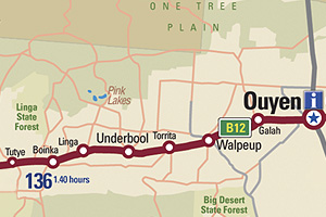
The northern area of Wyperfeld is 60 kilometres to the south-west, Hattah Lakes and the Murray River are 40 kilometres north and the Pink Lakes in the Murray Sunset National Park are only 70 kilometres to the west. Explore the parks to see an abundance of drought-resistant wildflowers (as many as 100 varieties), unique wildlife and breathtaking landscapes.
Ouyen is predominantly dry-land agriculture, including growing wheat and barley as well as and Prime Mallee Lamb production.
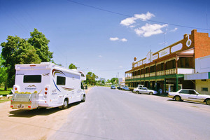
Hotel Victoria in Ouyen, Victoria
Things to do in Ouyen
• See the largest mallee stump in Australia, which is located beside the Calder Highway in the heart of town.
• Play bowls, lawn tennis or golf.
• Go shopping in the vibrant local shopping centre.
• See a film at the restored ROXY theatre.
• Dine at the Ouyen Club or the Victoria Hotel.
• Former home of the Great Vanilla Slice Triumph.
• Ouyen is a proposed site for mineral sand mining and potential for solar power systems.
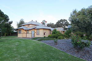
Old Court House at Ouyen, Victoria
Ouyen History
The reason the Mallee was the last region to be settled in Victoria is evident in the town's symbol - the mallee stump. It is a reminder of not only of the difficulties faced by European settlers in clearing the area, but also the agricultural basis of the region. The scrubby territory was once covered in the drought-resistant eucalypt (mallee), which proved very difficult to uproot and destroy. Any remnant of the subterranean root system led to regeneration and a heartbreaking renewal of efforts at clearing. Today the dense wood is used for wood turning and burning.
Before European settlement the area was probably occupied by the Wergaia Aborigines. Some believe the name Ouyen derives from the Wergaia term 'wuya-wuya', the name of a pink-eared duck, presumably once common in the area. Others say it means 'ghost waterhole'.
Ouyen developed around a railway station, which was established in 1906 after the Melbourne to Mildura line was built. Blocks in the area were sold in 1910 and cleared for sheep, wheat, barley and oat production.
Ouyen is now a transport and service centre for a vast area occupied by agricultural and pastoral properties and the sixth largest livestock exchange centre in Victoria.
Getting There
Ouyen is situated on the crossroads of the Calder Highway (Melbourne-Mildura) and the Mallee Highway (Sydney-Adelaide). The nearest townships are Mildura 110 kilometres to the north and Swan Hill 150 kilometres to the east.
Ouyen Services
-
 Ouyen Visitor Information Centre
Roxy Theatre complex,
Oke Street Ouyen, VIC 3490
Phone: (03) 5092 2006 -