


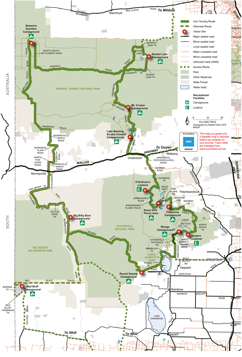
Mallee Drive ~ Parks Victoria
Experience the timeless outback landscapes of Victoria's Mallee, from sand dunes and Pink Lakes to woodlands and rolling plains, with abundant native wildlife and fascinating remains of the pastoral era.
-
Nature & Wildlife
• The Mallee Landscape
• Watching Wildlife
• Mallee Flowers
• The Honeydrippers
• The Precious Mallee Fowl
• 4 Wheel Driving
• Visitor Information - South Australian Mallee Parks
• Ngarkat Conservation Park
• Box Flat
• Pertendi Hut
• Pine Hut Soak
• The Border Track
• Baan Hill
• Billiatt Conservation Park
• Karte Conservation Park
• Peebinga National Park
• Parks Code
• Tracks of the Mallee - Victorian Mallee Parks
• Big Desert Wilderness Park
• Wyperfeld National Park
• Murray-Sunset National Park
• Pink Lakes
• 4WD in Victoria Parks
• Fire Safety
• Traditional Owners
• Track Classifications
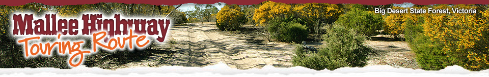
Big Desert State Forest, Victoria
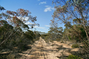
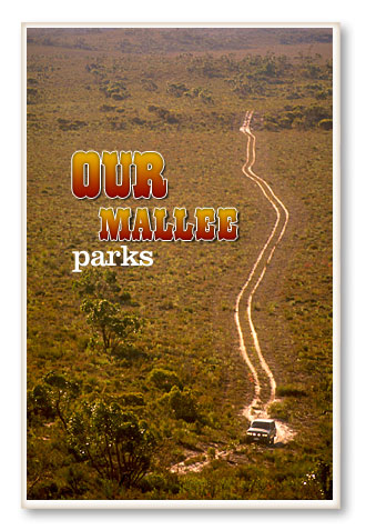
 It's a journey best undertaken at a leisurely pace to fully appreciate the abundant opportunities for relaxation and solitude, exploring by day before sitting around the campfire under starry skies. The tour features many of the scenic highlights of Wyperfeld and Murray-Sunset national parks, which protect over a million hectares of unique Mallee landscapes. It may be Victoria's driest region, but the Mallee is far from barren and lifeless. Large numbers of emus and kangaroos, native birds, attractive woodlands and colourful spring wildflower displays make this tour a nature lover's delight. The 625-kilometre drive is classified as Medium difficulty in dry conditions, under Victoria's new 4WD Recreational Track Classification System (see Track Classification section for details).
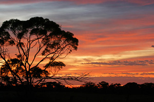
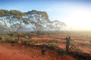
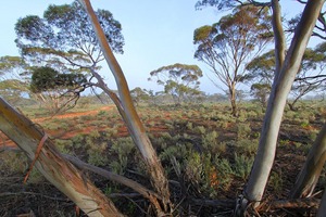
Mallee trees on sunrise
These parks are the two biggest of five continuous reserves which together form the largest remnant of uncleared native vegetation in the agricultural areas of south-eastern Australia. One of the most remote and least disturbed areas in Victoria, this park protects 142,300 hectares of the Mallee. The Big Desert Wilderness Park is home to a wide variety of birds, reptiles and mammals. It offers visitors an opportunity to experience true wilderness – this landscape has remained unaffected by human beings and provides a challenge for the experienced hiker.
The central feature of this huge, 356,800 hectare park is a chain of lake beds connected by Outlet Creek, the northern extension of the Wimmera River. The lakes only fill when the Wimmera River over-supplies Lake Hindmarsh to the south of Lake Albacutya – a rare event. When it rains the semi-arid landscape is miraculously transformed by tiny desert plants that sprout from long-dormant seeds, carpeting the ground with clusters of flowers. Many people prefer to visit in the cooler months of the year.
O'Sullivan's Pine Plains Lodge is hand hewn from local timber, and built in drop log style, as was the original Pine Plains Homestead. Pine Plains was the closest pastoral run to Kow Plains, mail was brought on horseback from Dimboola by a 14 year old Hugh O'Sullivan, who later purchased Pine Plains
Run in 1914. A grazing lease was added to
the existing Wyperfield National Park in 1996.
Access to Pine Plain is from Underbool, just west of the town, via the Patchewollock Road. Then via Gunners Track which is suitable only for 4WD, distance 36km, or from Walpeup to Patchewolock and then to Pine Plains via an all bitumen road.
For more information visit www.pineplainslodge.com
Murray-Sunset National Park, Victoria
Be enchanted by the fascinating Aboriginal history of Murray-Sunset revealed on scar trees and hearths. Explore remnants of the pastoral era such as the Shearers' Hut, Mopoke Hut and Pine Tank.
Marvel at the colour of the salt lakes and discover the remnants of an old salt mine.
Each is a treasure trove of holiday discovery!
Outback - not out of Reach
If you're looking for outback, look no further than the 'soft outback' of Murray-Sunset. Enjoy driving, bushwalking and camping or take your Four Wheel Drive for an adventurous trek or join a tag-along tour. From the picturesque Pink Lakes to the majestic River Red Gums on Lindsay Island and the vast number of protected wildlife species.
Murray-Sunset National Park, Victoria
The area became a National Park in 1991 protecting Victoria's largest flower, the Murray Lily, the restricted Silvery Emu-Bush and the Blue-Leafed Mallee. Walk softly throughout the Park as you may discover a number of threatened species. The Paucident Planigale, a small carnivorous marsupial, the slender yellow and green Regent Parrot, and the Millewa Skink all make their homes at Murray-Sunset.
Enjoying the Park
Just south-west of Mildura, Murray-Sunset is easy to access. As the second largest park in Victoria, you will have no trouble finding it! The main entrance is off the Calder Highway or access the Pink Lakes directly through Linga and Underbool. Be sure to pick up a park guide from the Alfred Deakin Centre before you leave Mildura. That way you can plan your trip so that you don't miss a thing! Day tours from Mildura and Ouyen are also readily available. Just ask at the Visitor's Information Centre – Freecall: 13 1963. While you're in the area, plan a stop at Lake Cullulleraine, browse through Meringur Historic Pioneer Park and the Pioneer Farm at Werrimull. Not to be missed!
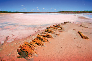
The Pink Lakes, Murray-Sunset National Park
The Pink Lakes in the Murray-Sunset National Park, are outstanding subjects for photos, the colour most intense on an overcast day. The colour of the lakes is due to the red pigment secreted by neighbouring aquatic plants. Also, during spring, the Spider orchids, Azure Sun orchids, Desert baekia and the Poached-egg daisies around the lakes provide surreal subjects for photos! The vast salt lakes, referred to as the Pink Lakes, dance with colour.
To understand where all the salt comes from, first you need to know that the Murray-Darling Basin sits on a 65 million year old sea bed. European settlement has changed the landscape and as a consequence, rising water tables are bringing salt previously stored undisturbed to the surface where it affects soils, streams and vegetation causing widespread salinization.
FOUR WHEEL DRIVING IN VICTORIA'S PARKS AND FORESTS
• Plan ahead and obtain a detailed map before you go – this map is a guide only
• Drive vehicles only on formed roads and vehicle tracks that are open to the public – do not drive off-track
• Stay off tracks that are too wet, or have been recently graded
• Avoid wheel spin and churning up the track surface
• Remove fallen trees or limbs from roads; don't create new tracks by driving around them
• Cross rivers and streams only where river crossings are clearly marked. Check depths and drive slowly
• Use a tree protector if winching is required and use wheel chains as a last resort
• Be aware that Seasonal Road Closures exist across Victoria due to the potential for increased environmental impacts and risks to public safety during the wetter months
• Be sure to check for road closures before you go
Off-Road Mellee Tracks
Check with Parks Victoria – 13 1963
www.parkweb.vic.gov.au
Department of Sustainability and Environment – 13 6186
www.dse.vic.gov.au
The best way to enjoy four wheel driving is by joining one of the many four wheel driving clubs in Victoria.
Contact Four Wheel Drive Victoria for more information.
www.fwdvictoria.org.au
OFF-ROAD DRIVING TECHNIQUES
Off-road driving demands different techniques to road driving, and every surface has its own particular characteristics. All vehicles should be in firstclass mechanical condition and carry equipment appropriate to the trip. It may be worth considering one of the training programs for touring off-roaders run by Four Wheel Drive Victoria to ensure you are properly prepared. Here are some brief pointers.
QUICK TIPS: Sand
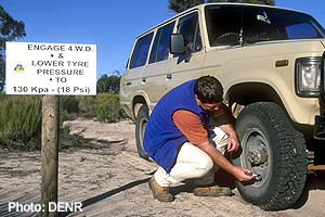
• Take a shovel, sand flag, flat plate so the jack doesn't sink in, compressor and tyre pressure gauge
• Full tank of fuel as consumption is high
• Pole and red sand flag so you can be seen approaching dunes.
Preparation
• Lower tyre pressures (15 psi for medium/large sized 4WD wagons)
• Remove weight from the vehicle
• Fit pole and red sand flag.
Driving
• Use steady momentum, but not aggressive driving
• High range for higher speed, low range for tight tracks
• Keep the speed down even when it's flat
• Disable stability control, engage 4WD. Cross-axle lockers aren't often useful
• If the wheels spin, immediately stop and back out. Don't spin your vehicle's wheels into a hole
• Lights on for visibility
• Accelerate gently, brake by just coming off the accelerator.
TREAD LIGHTLY IN THE VICTORIAN BUSH
Please help protect the natural environment by following these guidelines:
• Keep to walking tracks. Short cuts cause erosion and disturb native habitat
• If you carry it in – carry it out! Please take your rubbish out
• Dogs, cats or other pets are prohibited in National Parks
• Firewood is limited. Please use fuel stoves for cooking, and observe fire regulations and days of TOTAL FIRE BAN
• Avoid resting, picnics or camping under or close to River Red Gum trees. They may drop heavy branches at any time without warning.
• Be self-sufficient with drinking water. Carry it in and/or know how to make untreated water safe for drinking
• Camp at least 20 metres from any stream, lake or reservoir
• Dispose of and dirty water away from streams and waterways. Do not use soaps, detergents and toothpaste near water sources so fish and wildlife aren't harmed
• Use toilets where provided or bring your own portable toilet. If there are no toilets, walk at least 100 metres from water sources and campsites, dig a hole 15 centimetres and cover
• Light fires in designated fireplaces. Use a fuel stove where possible as it's better for the bush.
A bushfire survival plan is just as essential for drivers and campers as it is for those at home. Check the weather forecast before you go, stay aware of daily conditions and be ready to activate your bushfire survival plan. Remember that official warnings of bushfires are not always available in remote locations, so extra effort is required to keep informed. If you are camping, take a portable radio and tune in to ABC or local outlets for weather and fire updates.
Monitor conditions with updated bushfire information from the Victorian Bushfire Information Line: 1800 240 667. Extra care must be taken with any potential ignition sources like power tools and cigarette butts. Vehicles should not be driven over dry ground cover or parked on dry grassy areas.
TRADITIONAL OWNERS
Parks Victoria acknowledges the Traditional Owners of this land and recognises their rich culture and intrinsic connection that stretches back over many tens of thousands of years, including the areas now managed as parks.
Track Classification
A classification system for 4WD tracks on Public Land across Victoria
has been developed. A standard four level colour coded system is used to indicate the degree of difficulty of 4WD tracks and routes. Standard symbols and signage are used
to show easy to very difficult tracks. The Mallee Drive is rated as Medium.
(see Track Classification section for details).
• Mainly High Range 4WD but Low Range required
• Some 4WD experience or training required
• Tracks with some steep and/or rocky/slippery/sandy sections
• Some tracks may develop deep holes after rain ('Crab Holes'). Be aware and slow down on clay surfaces
• May have shallow water crossings
• Suitable for medium clearance vehicles with dual range and all terrain or road tyres
• Recommended to be done in groups of vehicles
• Will be more difficult in wet conditions.
The terrain and track conditions aim to provide a general description of the likely terrain and have limited subjective comments such as boggy or rutted as these can be interpreted differently by individuals. The suitability of a vehicle relates to high/low range capacity, ground clearance and tyres. The recovery equipment is advisory only and in line with Tourism Adventure Activity Standards and is not mandatory. This is to guide the inexperienced driver that it may be in their best interest to have driver training or further experience before attempting more difficult terrain.
Note: Drivers need to be aware of changing weather conditions and how this may affect tracks they are using or planning to use. The tracks have been classified in dry conditions and most medium, difficult and very difficult tracks will become more difficult in wet weather.
Source: Parks Victoria ~ healthy parks healthy people
-
Border Track and Parks Information
Mallee District National Parks and Wildlife SA - Lameroo Office
For Ngarkat, Billiatt, Karte and Peebinga Parks
Phone: (08) 8576 3690 - Parks Victoria
Phone: 13 1963
www.parkweb.vic.gov.au
Department of Sustainability
and Environment 13 6186
www.dse.vic.gov.au - Emergency Services
Ambulance: 000
Police: Pinnaroo - (08) 8577 8077
Police: Ouyen - (03) 5092 2502
Lameroo Hospital: (08) 8576 4600
Ouyen Hospital: (03) 5092 1111
RAA / RACV: 13 11 11
-
Nature & Wildlife
• The Mallee Landscape
• Watching Wildlife
• Mallee Flowers
• The Honeydrippers
• The Precious Mallee Fowl
• 4 Wheel Driving
• Visitor Information - South Australian Mallee Parks
• Ngarkat Conservation Park
• Box Flat
• Pertendi Hut
• Pine Hut Soak
• The Border Track
• Baan Hill
• Billiatt Conservation Park
• Karte Conservation Park
• Peebinga National Park
• Parks Code
• Tracks of the Mallee - Victorian Mallee Parks
• Big Desert Wilderness Park
• Wyperfeld National Park
• Murray-Sunset National Park
• Pink Lakes
• 4WD in Victoria Parks
• Fire Safety
• Traditional Owners
• Track Classifications